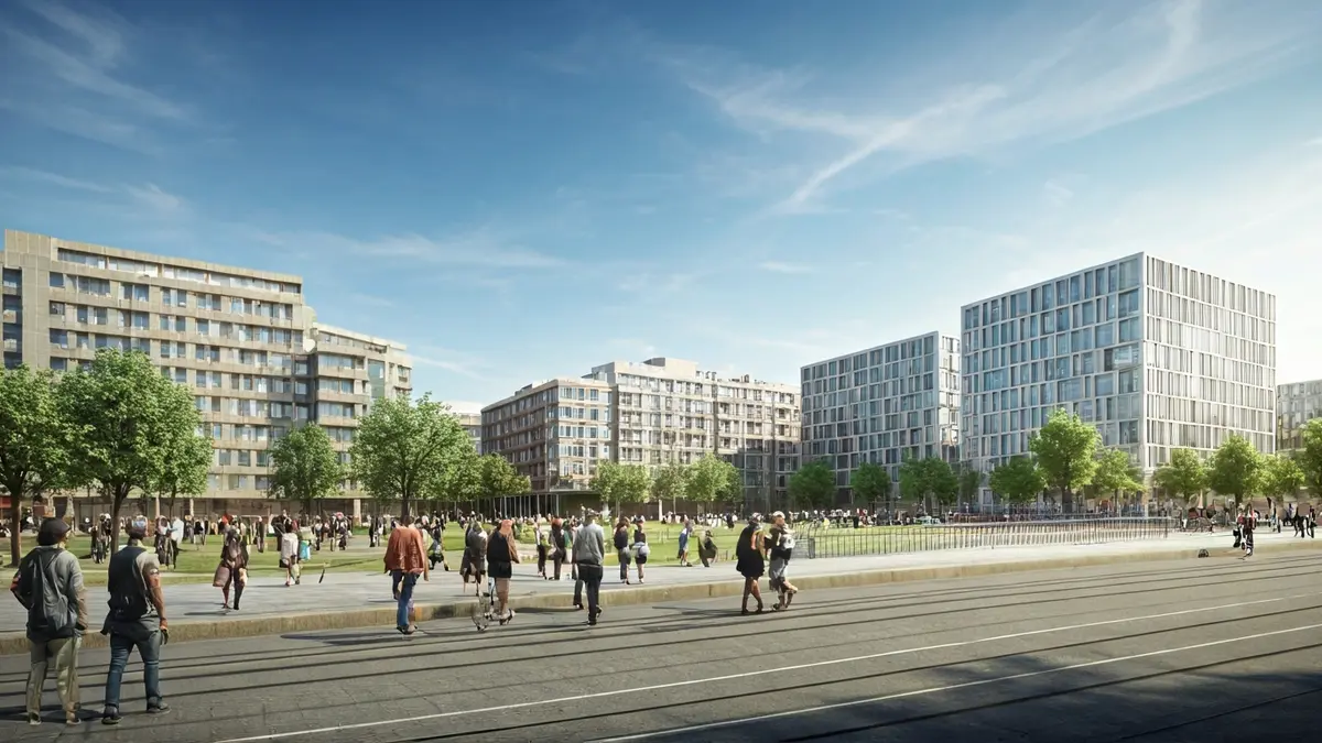
The Governing Board of the Madrid City Council has taken a significant step in the development of Madrid Nuevo Norte by initially approving the Draft Statutes and Action Bases for the constitution of the Compensation Board for the Malmea-San Roque-Tres Olivos area. This zone is set to become the sector with the largest number of residences within the operation, totaling 7,100 homes. Of these, over 1,400, representing 20%, will have some form of public protection, while the remaining 5,700 will be market-rate housing, as detailed by Deputy Mayor and municipal spokesperson, Inma Sanz.
The project includes the creation of essential new public facilities, such as health, educational, sports, and social services, designed to meet the needs of future residents. Additionally, two major public transport hubs are planned, located to the north and south of the area. Each hub will integrate a new Metro and Cercanías (commuter rail) station, along with several stops for a high-capacity priority bus system, operating with dedicated lanes and traffic light priority. The initiative, promoted by the Urban Planning, Environment, and Mobility Department, will allocate 509,246 m² to local public networks, allowing residents to enjoy over 160,000 m² of green areas and open spaces, as well as 136,000 m² for social facilities and urban services, and another 210,000 m² for public roads. Furthermore, 214,864 m² will be designated for tertiary office use and 36,119 m² for tertiary commercial use.
One of the prominent features of this development is the creation of a large north-south environmental axis, integrating the new areas through an extensive linear park. This “green axis” of Madrid Nuevo Norte will connect the natural ecosystems of El Pardo mountain, along the extension of Agustín de Foxá street, with the Paseo de la Castellana. Cycling mobility will also be enhanced with a new network of lanes connecting to the Anillo Verde Ciclista (Green Cycling Ring) and the Colmenar Viejo bike lane. Regarding the protection of existing heritage in this environment, the file guarantees the preservation of the Profidén Building and the hermitages of Nuestra Señora de Lourdes and San Roque, all cataloged with protection level 2, in their current locations.
This urban development will also bring significant improvements to the infrastructure in northern Madrid and for the entire city. East-west road connectivity will be enhanced from the old town of Fuencarral to Las Tablas through three bridges and a tunnel: the Malmea bridge, the extension of Cardenal Herrera bridge, the Monasterio de Arlanza bridge, and the Afueras de Valverde tunnel. To the south, three bridges will be built over the M-30, two new ones on Agustín de Foxá and Antonio Cabezón streets, and the existing pedestrian bridge in Mauricio Legendre will be reformed and widened, connecting it to the Chamartín Business Center. The implementation of this initiative will eliminate a historical urban divide that isolated entire neighborhoods.
The modification of Madrid's General Urban Planning Plan, known as “Prolongación de la Castellana,” was approved on May 29, 2020, by the City Council Plenary and definitively ratified by the Community of Madrid on July 22, 2020. Madrid Nuevo Norte will span 5.6 kilometers from north to south and cover over 3.3 million square meters, of which 400,000 m² will be dedicated to green areas, including a 13-hectare central park. 76.65% of the land will be for public use and ownership. New connections over train tracks and the M-30 are planned, with five bridges, a tunnel, and a pedestrian walkway, and up to 20 hectares of railway tracks will be covered. The main objective is to enhance Chamartín station as the core of Madrid's new Business Center and promote a mobility model where public transport accounts for 80% of journeys, in addition to boosting public housing policies with 20% of residential buildable area allocated to protected housing.